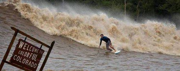
I am trying to put together some information and links to show the flood impact to Colorado. Most of the information is from local news stations. Greeley and Weld County sits on the high plains of Colorado. We are about 50 miles north of Denver, 30 miles east of Loveland, 40 miles south east of Fort Collins. The two rivers, South Platte and Cache La Poudre, run past Greeley and join on the east side of the city. Both rivers carried all of the rain water that occurred over three days. Thousands of people have been impacted, towns and communities in the mountains and low lands have been isolated with roads being washed away and sewage treatment system washed out. More towns in eastern Colorado are still to be impacted as the flood waters head eastward. It is estimated that approximately 4500 sq. miles of Colorado is impacted by the flooding.
Two weeks ago and earlier we were burning up in Colorado. Forest fires and and temperatures in the high 90s (normal temps for this time of year is in the low to mid 80s) to now being washed away.
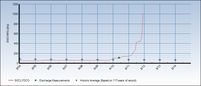
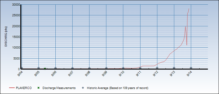
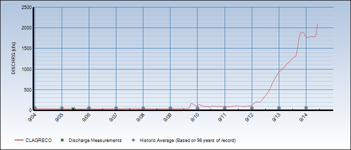
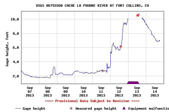
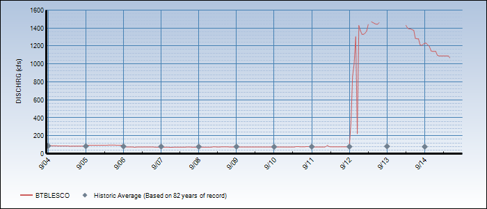
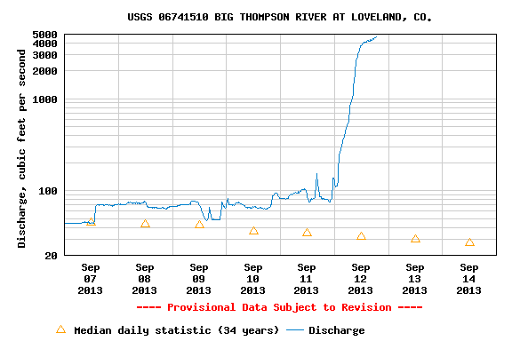
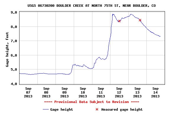
Water flow charts.
This is from the Weld County site and shows the flood impact in the county If you zoom in you will get more detail of the area.
Below are local TV news reports and videos.
http://www.9news.com/images/video/140/105/2/1/urlbcdownload.gannett.edgesuite.net/kusa/34295199001/201309/3260/34295199001_2671465713001_th-52345d4de4b012dc8038468a-672293877001.jpg
http://www.9news.com/video/default.aspx?bctid=2672777464001&odyssey=mod|newswell|text|FRONTPAGE|featured
http://www.9news.com/video/2672803203001/1/Flood-waters-debilitate-many-Colo-cities
http://media.thedenverchannel.com/photo/2013/09/13/Flood_devastation_in_Weld_County_917550000_910552_ver1.0_60_45.jpg
A ride and rescue up the Big Thompson River Canyon